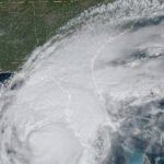
Hurricane Erick rapidly strengthened Wednesday afternoon into a potent Category 2 storm as it churned toward Mexico’s southern coast amid warnings it was likely to become a dangerous major hurricane that would threaten the region with damaging winds, life-threatening flash floods and mudslides.
The hurricane’s maximum sustained winds had risen by early afternoon to 100 mph as the intensifying storm headed toward an expected landfall sometime Thursday, the U.S. National Hurricane Center in Miami said.
By Wednesday afternoon, Erick was centered about 105 miles south of Puerto Ángel and about 215 miles southeast of Punta Maldonado in the eastern Pacific, the latest hurricane center advisory said.
Forecasters said Erick was expected over the coming hours to lash Mexico’s Pacific coast with heavy rain, strong winds and a fierce storm surge. Rains of up to 20 inches could fall across the Mexican states of Oaxaca and Guerrero, with lesser totals in Chiapas, Michoacan, Colima and Jalisco states, the center’s advisory says. The rainfall threatened flooding and mudslides, especially in areas with steep terrain.
The hurricane center said Erick was forecast to reach major hurricane strength late Wednesday night or early Thursday near the coast and is then expected to move inland. A major hurricane is defined as Category 3 or higher and wind speeds of at least 111 mph.
Hours earlier, Erick was a Category 1 hurricane with maximum sustained winds of 85 mph moving northwest toward the coast at 8 mph.
Click this link for the original source of this article.
Author: Dillon B
This content is courtesy of, and owned and copyrighted by, https://www.offthepress.com and its author. This content is made available by use of the public RSS feed offered by the host site and is used for educational purposes only. If you are the author or represent the host site and would like this content removed now and in the future, please contact USSANews.com using the email address in the Contact page found in the website menu.


