The U.S. East Coast dodged a massive bullet this week as powerful Category 3 Hurricane Erin passed near the Bahamas on Tuesday morning. Instead of making landfall, Erin is expected to unleash rough surf from Central Florida to Canada before curving out into the western Atlantic later this week. This has certaintly brought excitement for East Coast surfers.
At 0500 ET, Erin was approximately 700 miles southwest of Bermuda and 750 miles south-southeast of Cape Hatteras.

“Erin forecast to substantially grow in size while moving over the western Atlantic through the week,” National Hurricane Center Meteorologist Robbie Berg wrote in a note, warning, “Dangerous rip currents expected along U.S. East Coast beaches.”
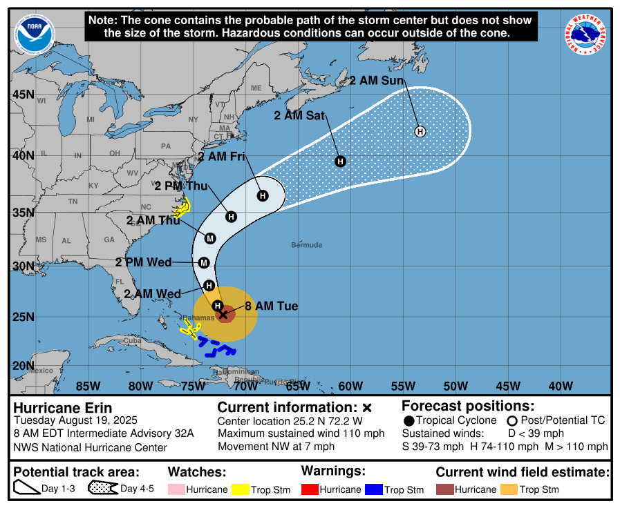

Tropical storm and storm surge watches have been issued for the Outer Banks of North Carolina all the way up to the Mid-Atlantic states.
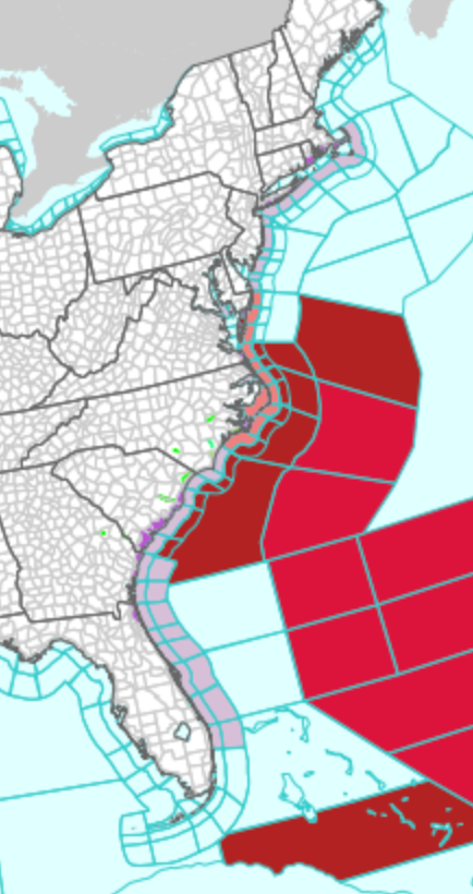
Local media outlets reported that evacuations are underway in the Outer Banks area as the storm approaches.

Here’s the latest forecast track (East Coast dodged a bullet):

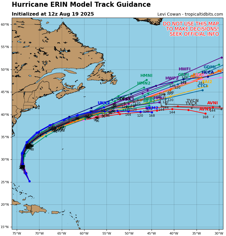
The most active part of the Atlantic Hurricane season has arrived after a relatively quiet first half.

. . .
Tyler Durden
Tue, 08/19/2025 – 11:00
Click this link for the original source of this article.
Author: Tyler Durden
This content is courtesy of, and owned and copyrighted by, https://zerohedge.com and its author. This content is made available by use of the public RSS feed offered by the host site and is used for educational purposes only. If you are the author or represent the host site and would like this content removed now and in the future, please contact USSANews.com using the email address in the Contact page found in the website menu.